
Who is John Nelson?
John Nelson makes maps that stop you scrolling. He blends art, science, and a friendly teacher vibe that pulls in everyone from GIS pros to curious newcomers. His voice is warm, practical, and a little playful. The result is content that teaches, inspires, and gets saved.

.png)

John Nelson: Turning maps into stories people actually feel
John Nelson makes maps that stop you scrolling. He blends art, science, and a friendly teacher vibe that pulls in everyone from GIS pros to curious newcomers. His voice is warm, practical, and a little playful. The result is content that teaches, inspires, and gets saved.
1. Who he is
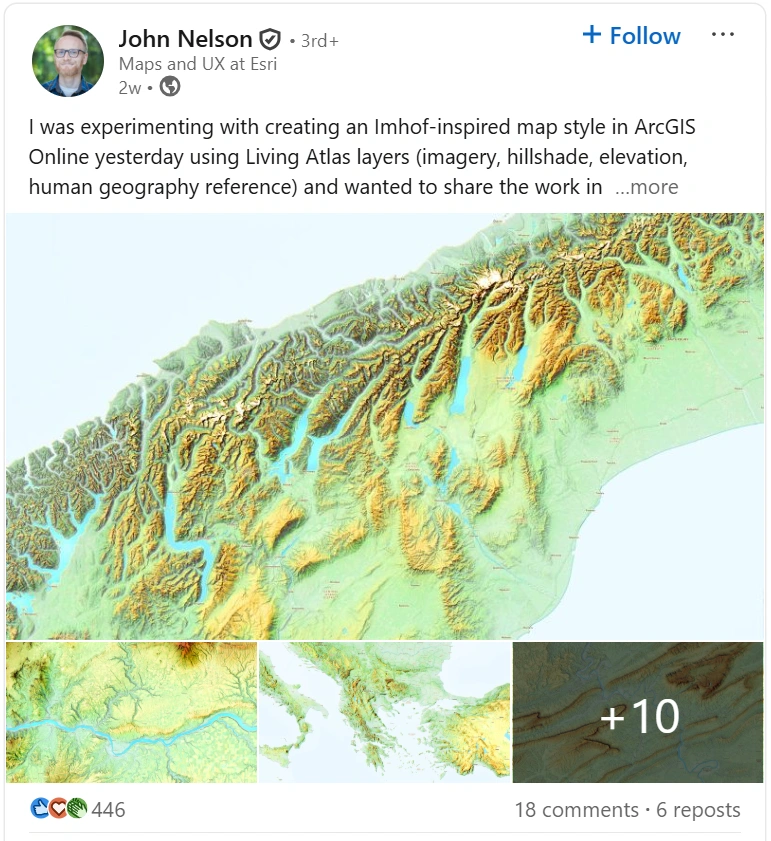
John is a cartographer and UX designer at Esri, based in Michigan. He creates tutorials, videos, and show-and-tell posts that explain complex spatial ideas in plain language. His work has appeared in outlets like National Geographic and Fast Company, and he presents at mapping conferences worldwide. Inside Esri he champions new techniques for ArcGIS, spatial analysis, and visualization craft. Outside the office he nurtures a global community of map lovers through generous how-to content and creative experiments. He positions himself as the approachable expert who turns advanced GIS into hands-on skills.
2. A Network of Heavyweights
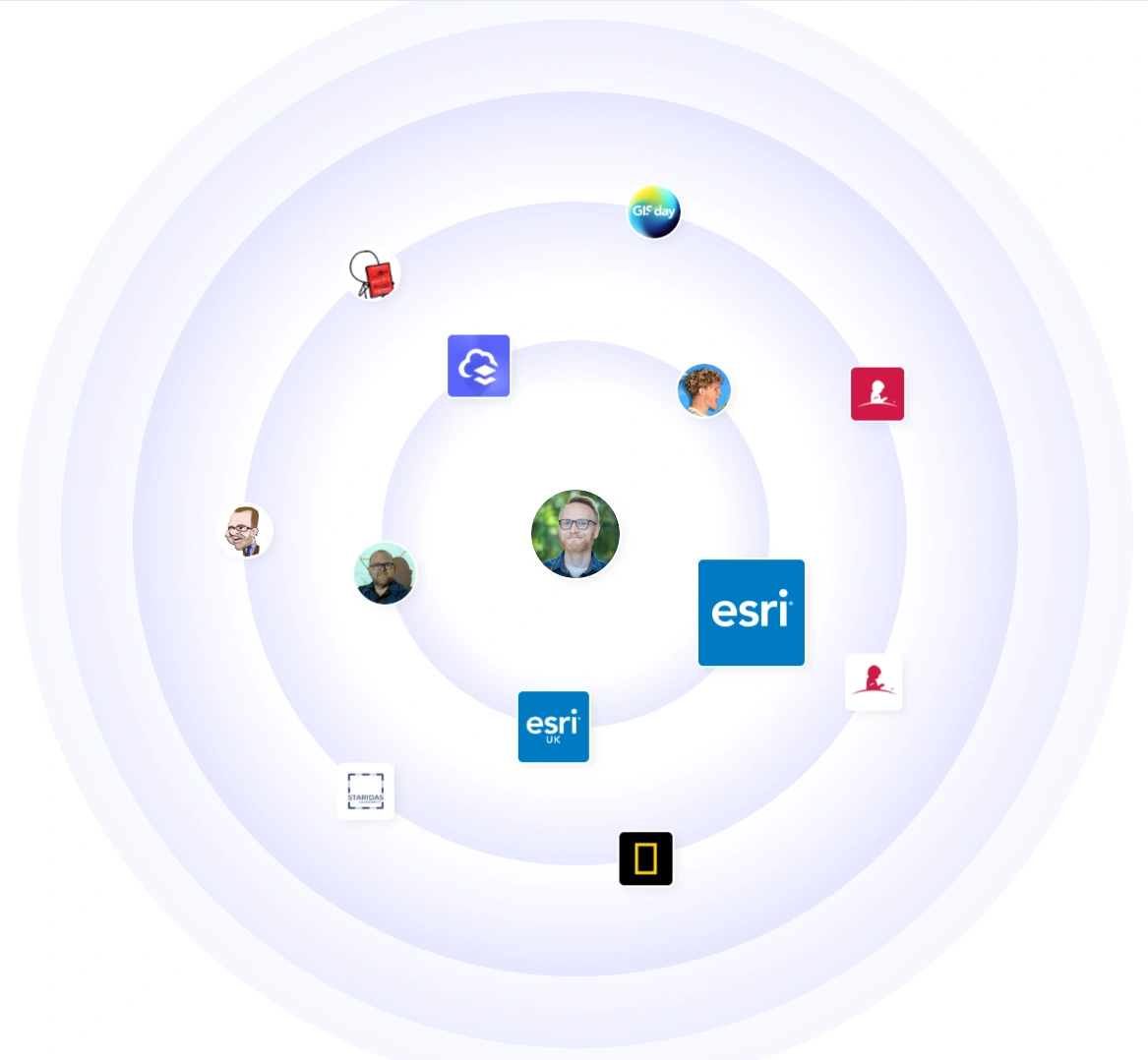
John sits at the center of the GIS universe. He collaborates with Esri and Esri UK, swaps knowledge with leading cartographers and educators, and engages with institutions seen across his graph such as National Geographic and St. Jude. His audience includes tech practitioners, educators, and data storytellers who build with ArcGIS every day. When he posts, industry voices join in.
3. Why people listen
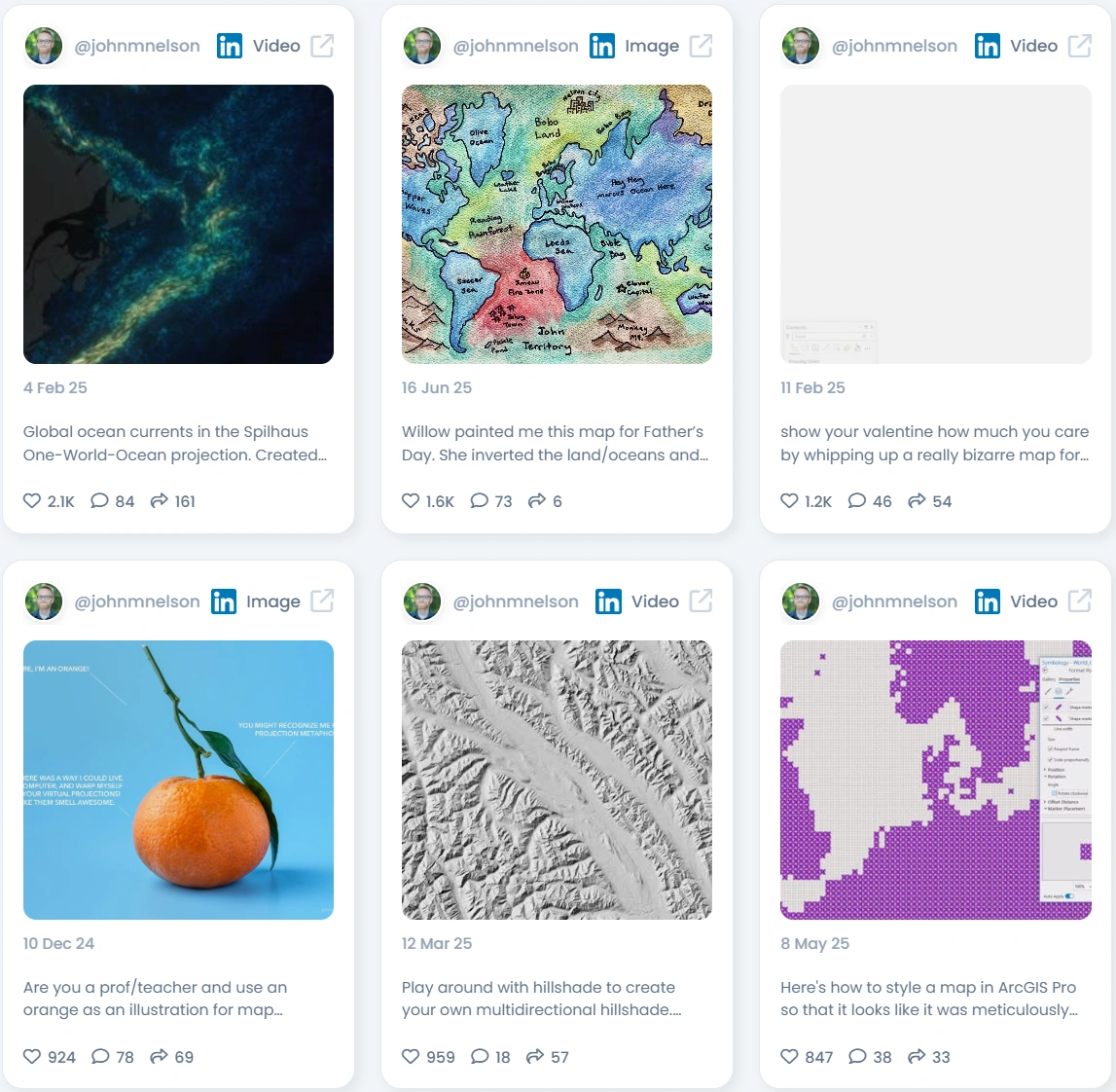
He shows his work. John shares step-by-step workflows, styles, data sources, and the thinking behind each map. He mixes polished visuals with quick experiments, which makes learning feel accessible. Humor shows up just enough to keep the feed human. People leave smarter than they arrived.
4. Authenticity that resonates
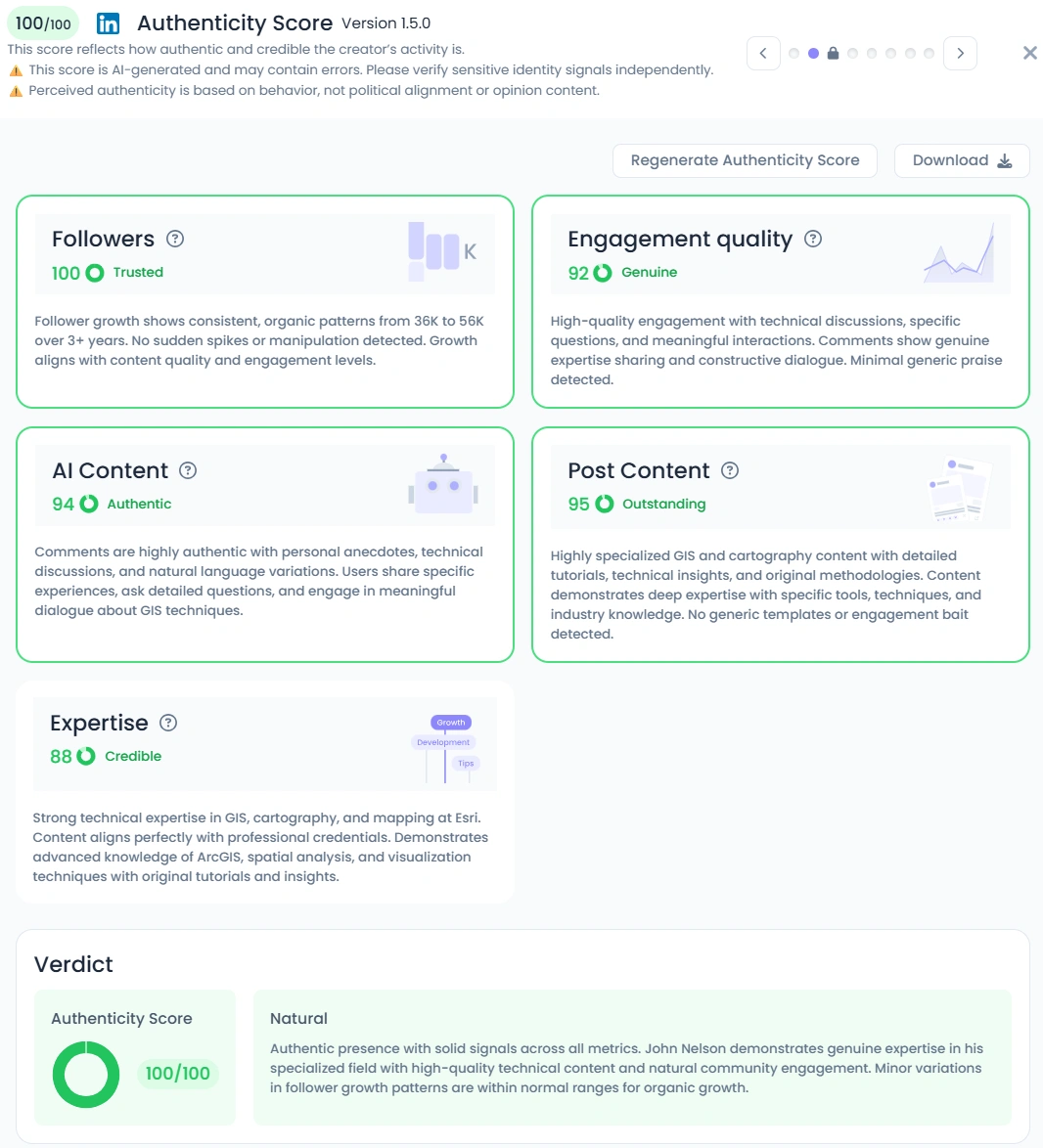
Favikon scores John at 100 out of 100 for authenticity, backed by 92 for engagement quality and 95 for post content. Comments read like studio notes from real practitioners who reference their own projects and ask sharp questions. You see personal bits too, like a hand-drawn map from his daughter or a quirky orange used to teach projections. Authority meets real life, which is why his community trusts him.
5. Numbers that back it up
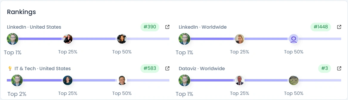
John reaches a large and loyal niche with more than 56k on LinkedIn, 35k on YouTube, plus active audiences on X and Instagram. He posts at a vigorous rhythm of about 28 times per month while keeping engagement very good. His influence score sits at 7,996 points with top percentile rankings on LinkedIn and a top 3 position worldwide in Data Visualization. Growth is steady and organic.
6. Collaborations that matter
Brands and institutions partner with John when they want credibility with GIS professionals. He showcases ArcGIS capabilities, highlights community projects, and demonstrates techniques that teams can adopt the same day. Conference organizers book him for live tutorials and design breakdowns that fill rooms and drive post-event learning.
7. Why brands should partner with John Nelson
If you need to reach GIS users, educators, and data storytellers, John brings trust and immediate utility.
- Host a live workshop where John builds a map from raw data to publish-ready in under an hour
- Co-create a tutorial series that turns your geospatial feature into repeatable workflows
- Produce a design teardown of real customer maps to show improvements and ROI
- Launch a community challenge with templates, styles, and a gallery that showcases the best work
8. Why John Nelson is relevant in 2026
Maps sit at the heart of climate reporting, supply chain risk, urban planning, and AI-powered analytics. Teams want skills, not slogans. John converts emerging GIS capabilities into clear, repeatable practices. As spatial data floods every industry, his blend of creativity and instruction makes him a go-to guide for the next wave of geospatial storytellers.
Conclusion: Craft That Sticks
John reminds the industry that maps are not just layers and labels. They are stories people can feel. With elite credibility, a generous teaching style, and a thriving community, he turns advanced GIS into everyday wins. Work with him when you want geospatial content that educates, travels, and lasts.
Related Articles
See all the articles


Favikon is an influencer marketing sofware. We are not affiliated, associated, endorsed by, or in any way officially connected with the Tiktok, Youtube, LinkedIn or Instagram brand, or any ot ifts subsidiaries or its affliates. The names "Tiktok", "Youtube", "LinkedIn" and "Instagram" as well as related names, marks, emblems and images are registered trademarks of their respective owners.
Copyright © 2025 Favikon | All Rights Reserved
